Alaska Trip Memories

We had fully intended to keep a journal of our driving trip to Alaska. Our New Zealand 2010 blog has been a wonderful way to preserve memories and organize photos. With a little perseverance, I think we just may be able to think back and create something similar for the Summer of 2009.

Entering Alaska from Canada on the ALCAN Highway

Be sure to read the oldest post(s) first and then click on Newer post link at the bottom left of the post you're reading. Or use the Blog Archive links in the right column to find the chronology of the posts.

Note: click on a picture to see a larger version of it. If set your browser to Full Screen (using F11 or Cmd-Shift-F) the larger image will be almost full screen for most displays.

Hope you enjoy!

Susan & Mike

Back Home and Final Thoughts


After Banff the trip began to feel almost like going downhill. Anticlimactic. We spent a night in Billings again and then drove straight home. Montana and Wyoming are beautiful, but the landscape was almost prosaic after the astonishing scenery we had in our rear-view mirror.

It felt good to be back in Colorado and we had a lot to catch up on. Our new car wasn't so new any more. There was lots of dirt and gravel and mud and sand and tar to remove, but we smiled as we remembered where we picked it all up.

What a summer we had! The entire journey took just about 7 weeks from start to finish and covered about 9,500 miles. This was the longest road trip either of us had ever taken and the time just flew by. There are too many firsts and bests to try to list here. The trip just felt "once-in-a-lifetime" even though we've had other similarly epic "road trips" since then (like New Zealand) and we plan to have more.

Alaska is Big! (image source: Wikipedia)

One of the most interesting lessons learned was about mountains. We expected a lot of big mountain ranges and peaks, since we were traveling to and through the northern Canadian Rockies, and we knew that Denali, at 20,328 ft was the highest peak in North America. But we soon had our eyes opened to the mountains beyond the Colorado Rockies. Colorado is beautiful but the Canadian Rockies and the mountains of Alaska are gloriously, stupendously big and just never seem to end. By the end of the trip we were somewhat embarrassed to admit that we had become a little snobbish about our local mountains. Not any more!


Denali (aka Mt McKinley), 20,328'

We also now realize that even 7 weeks can't do Alaska (and Canada) justice. A full 2-3 weeks was just getting there and making transitions between places! There is so much to see, so much ground to cover, so many hikes to do. We went as far and as deep as we could, and it was very exciting and satisfying, but we still often felt we had only scratched the surface. During the trip we kept saying, "we've got to come back here!"

Some of our favorite places were the Al-Can Highway, Banff/Jasper, Yukon Territory, Fairbanks, Denali National Park and Preserve, Turnagain Arm, the Kenai Peninsula, Chitina/Wrangell-St Elias NP, Haines, Glacier Bay NP, Junuea, the Inside Passage -- uh, wait -- that's pretty much everything we did! :-)

One really enjoyable aspect of our journey was the people along the way. We found Canadians to be exceptionally friendly and efficient, with none of the "attitude" you sometimes see from demotivated employees and people when traveling in the U.S. Alaskans were also very helpful and friendly and seemed welcoming of us as tourists.

We have always been enthusiastic observers of nature and wildlife, and Alaska and Canada definitely did not disappoint! But we view our Alaskan adventure as the genesis of our interest in birdwatching, mostly because of Bald Eagles, Sandhill Cranes, puffins, and a handful of other interesting birds we saw.

This adventure also renewed our interest in photography and trying to capture those awe-inspiring views and moments not only for our memories, but to share our experience with family and friends. And of course, with more photography experience and better gear, we're already thinking of what we need to re-shoot.

What did we miss? Next time we'd place a high priority on Katmai, Kodiak Island, the road to Prudhoe Bay, and we'd love to return to Haines. We'd probably take another flight-seeing trip, perhaps to Nome or in conjunction with Prudhoe Bay and/or the Arctic National Wildlife Refuge or Gates of the Arctic National Park and Preserve. We're even considering a cruise ship experience in the Inside Passage. And on our next trip, bird-watching will undoubtedly be a major priority in planning.

And although this blog was reconstructed 2-3 years after the trip, much of the trip is surprisingly fresh in our minds. Thanks to Susan, we began blogging our New Zealand trip, and liked the result so much that we knew we had to put out the effort to document Alaska, too. And we're glad we did.


Where to next? :-)

Mt Robson, Jasper and Banff (July 21-23)

Mt. Robson Provincial Park was beautiful, with considerably less crowds than the nearby National Parks.

We spent the morning enjoying the views but decided not to hike since there were no accommodations in the Park and the hikes were long. If we ever get into camping and backpacking, we must do the hike to Berg Lake along the Valley of a Thousand Falls.

Jasper National Park was next and this time we had a sunny day to appreciate it! We drove out to Maligne Lake, stopping first to hike all 6 bridges and take in the rushing waterfalls of Maligne Canyon.

Maligne Canyon hike

On the way back we stopped at Medicine Lake, which interestingly drains by an underground river system.

Medicine Lake on the Maligne Valley road in Jasper NP

Back in Jasper, we stayed at the Sawridge Inn again and had another good experience there. On the morning of July 22nd, we said goodbye to the Yellowhead Highway and headed south on Hwy 93 towards Banff.

We didn't get very far before turning off to see Mount Edith Cavell and the Angel Glacier. This is a stop not to be missed and easily worth the hike out to the glacier lake with closer views of the jagged mountain, named for a British nurse who helped allied soldiers in WWI escape to the Netherlands from occupied Belgium. Edith Cavell was executed by the Germans.


Mt Edith Cavell in Jasper NP

Mike at the glacial Lake below Angel Glacier and waterfall on Mt Edith Cavell

Athabasca Falls


Athabasca Falls was our next stop, right off of the highway, followed by Sumwapta Falls. We'll have to look into rafting next time.

Along the road through Jasper to Banff we stopped to observe Bighorn Sheep on the road.


Bighorn Sheep along the road

Scenery along Icefields Parkway from Jasper to Banff

With so much to see, along the way, we didn't make it to the Icefields Parkway until late in the afternoon. Not wanting to rush this final leg of our trip, we splurged (although they did give us a discount) and stayed at the Glacier View Inn where we had a view of the Athabasca Glacier from our room.

View of the Athabasca Glacier from our Glacier View Inn room

The massive Athabasca Glacier

Thought it was late, after we checked into our room, we hiked closer to the tongue of the Athabasca Glacier and got to enjoy some evening light on the surrounding mountains.


There was a glacier bus tour the next morning we could've taken but we elected to move along.

Stunning views abounded all the way down to Lake Louise Thursday morning. We had lunch at the Chateau Lake Louise patio and started talking about what to do next.

A typical view in Banff NP

A black bear observed from the road
Susan enjoying the poppies near our lunch spot at Lake Louise

There is so much to see in Jasper and Banff, and we had been on the go so much, we hadn't scratched the surface of hiking. But we started to feel home calling. Southern British Columbia seemed quite close, after being so much further norther. So we agreed we'd come back here another time, and stay longer.

We took a last look around, got back in the car and headed home. Only 1200 miles to go!

Panorama of Peyto Lake in Banff NP

Here's a map of our route for this leg of the trip, from McBride, BC to Banff.

View Larger Map

Yellowhead Highway 16 (July 19-20)

Totems in Gitwangak village
We were winging it all the way home now, with no set itinerary or reservations. After leaving the MV Malaspina, we drove the Yellowhead Highway (Canada 16) along the Skeena River from Prince Rupert, BC to Terrace, BC where we stayed at the Best Western Plus Terrace Inn.

This area is home to the rare white Kermodei Bears (locally the name was always spelled with the final "i"), known as Spirit Bears by the native peoples. A good article on the bears appeared in National Geographic in August 2011.

The next morning, just past the Seven Sisters Mountain Range, we stopped at the tiny native village of Gitwangak to see a collection of historic totem poles. The totems have been moved over the years to avoid flooding, but they are the largest totem collection in their original village anywhere in British Columbia.

As we drove around the village photographing more carvings in peoples' yards, wondering if it was appropriate to do so, a truck pulled up. A local gentleman got out and approached our car window. Apologizing in case he had startled us, he explained that he was a local Chief and was curious to know why were were there. Not because he had a problem with us being there, but rather because he wanted to find a way to draw more visitors, and thus bring more income, to the village. We didn't fully understand the situation, but it has something to do with the BC government not allowing the native tribes to advertise.

Gitwangak village and totem

Recently I found this blog post about the Gitwangak band. Scroll to the bottom for more information about the individual totems we saw.

We drove the rest of the day straight through, staying in McBride, BC that night, just an hour west of Mt Robson Provincial Park.

The road to McBride, BC, Canada

Here's a map of this segment of the trip, from Prince Rupert to McBride, BC.


View Larger Map

Inside Passage (July 17-19)

When we left for Alaska 6 weeks ago we didn't really think past driving the Alaska Highway to Fairbanks and seeing Denali, much less consider our route home.

Our digs on the MV Malaspina
While driving up, we thought we might return via the Top of the World Highway through Chicken and Dawson City, then on to Faro, with its rare Fannin Sheep. But we'd covered a lot of miles by car, and traveling the Inside Passage on the Alaska Marine Highway System would allow us to make some southbound progress without Mike having to be behind the wheel of the car.

We studied the schedules and routes and found that we could cruise at a discounted rate if we exited at Prince Rupert, BC instead of going all the way to Bellingham, WA. Plus that route would allow us to see new areas in the interior of British Columbia. We had a plan! We booked a berth with double bunks for two nights, and of course a space for our car.

Always something to see from the deck

Solarium on the Malaspina; backpackers were allowed to sleep here

Although not fancy, we found the MV Malaspina to be clean and comfortable. It had a nice little restaurant, solarium and up front in an enclosed area were comfortable chairs where we could enjoy the view and listen to the occasional naturalist talk. All sort of people were aboard, from backpacking tourists to a group of Sitka high school football players returning home from a game. Everything about our trip ran smoothly and we wouldn't hesitate to travel the Alaska Marine Highway again.

Mike on the deck reading Michener's "Alaska"

We cruised to Sitka, Kake, Petersburg, through the narrows to Wrangell, and Ketchikan before leaving Alaska and docking at Prince Rupert. Our trip was a through cruise, which didn't include time to get off and look around at these places any for any longer than it took to let passengers get on and off. But I did manage to convince Mike to run off the ship at Petersburg, in the rain, just to set foot briefly on the ground. We missed seeing Ketchikan because we stopped there after dark -- wait a minute -- it was actually getting DARK!

A rainy stop at Petersburg


Susan out on the deck looking for whales

The weather could have been better, but that didn't spoil absolutely the best part of the trip -- whale watching. From orcas to humpback whales, we couldn't get enough of it.

We saw a pod of perhaps a dozen humpback whales nearby

Humpback whales diving

Late in the afternoon of our third day at sea, rested and 4 degrees of latitude closer to home, we drove off the MV Malaspina and headed east.

Here are the main stops on the Alaska Marine Highway System between Juneau and Prince Rupert, BC, Canada:


View Larger Map

Juneau (July 14-17)

It was one thing for the tiny village of Seldovia to be isolated from land routes, but discovering that Alaska's capital city can only be reached by sea or air was amazing to us. The four hour ferry ride to Juneau was great and easy to arrange out of Haines.

The ferry terminal was just a few minutes from our B&B and we arrived plenty early to wait in line. We were watching some crows or ravens and someone told us they seemed to know the ferry schedules as they showed up to move down the line of cars waiting to board the ferry, picking dead insects from the front of the cars!

Soon it was time to drive Tina into the bowels of the ship, lock it up, then go up to the passenger area to enjoy the short cruise to Juneau. We were excited to be starting our Alaska Marine Highway Inside Passage journey south, and to have a break from driving our car.

Alaska Marine Highway ships dock at Auke Bay, a little north of town and away from where the cruise ships arrive. We drove our car off the ship and into town to check in at the Travelodge Hotel Juneau.

Juneau was pretty neat, with lush Southeast Alaska vegetation and flowers decorating steep and winding streets overlooking the bustling main harbor. Local businesses kept cruise ship schedules handy to anticipate the corresponding ebb and flow of passengers into their shops. As a "bore tide" of tourists poured in, we scurried back to our car to find a more peaceful place.

Bald eagles were everywhere around Juneau


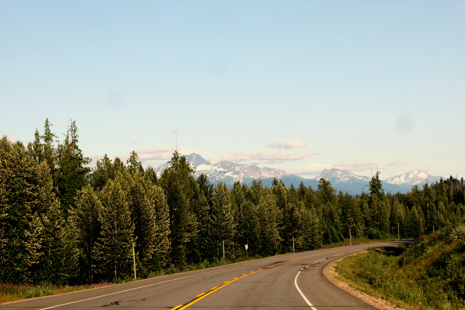
Once you leave the town proper, you have one choice. "The Road." It runs north and that's about all you have to know to get around Juneau.

You don't see mileage to the "End of Road" very often :-)

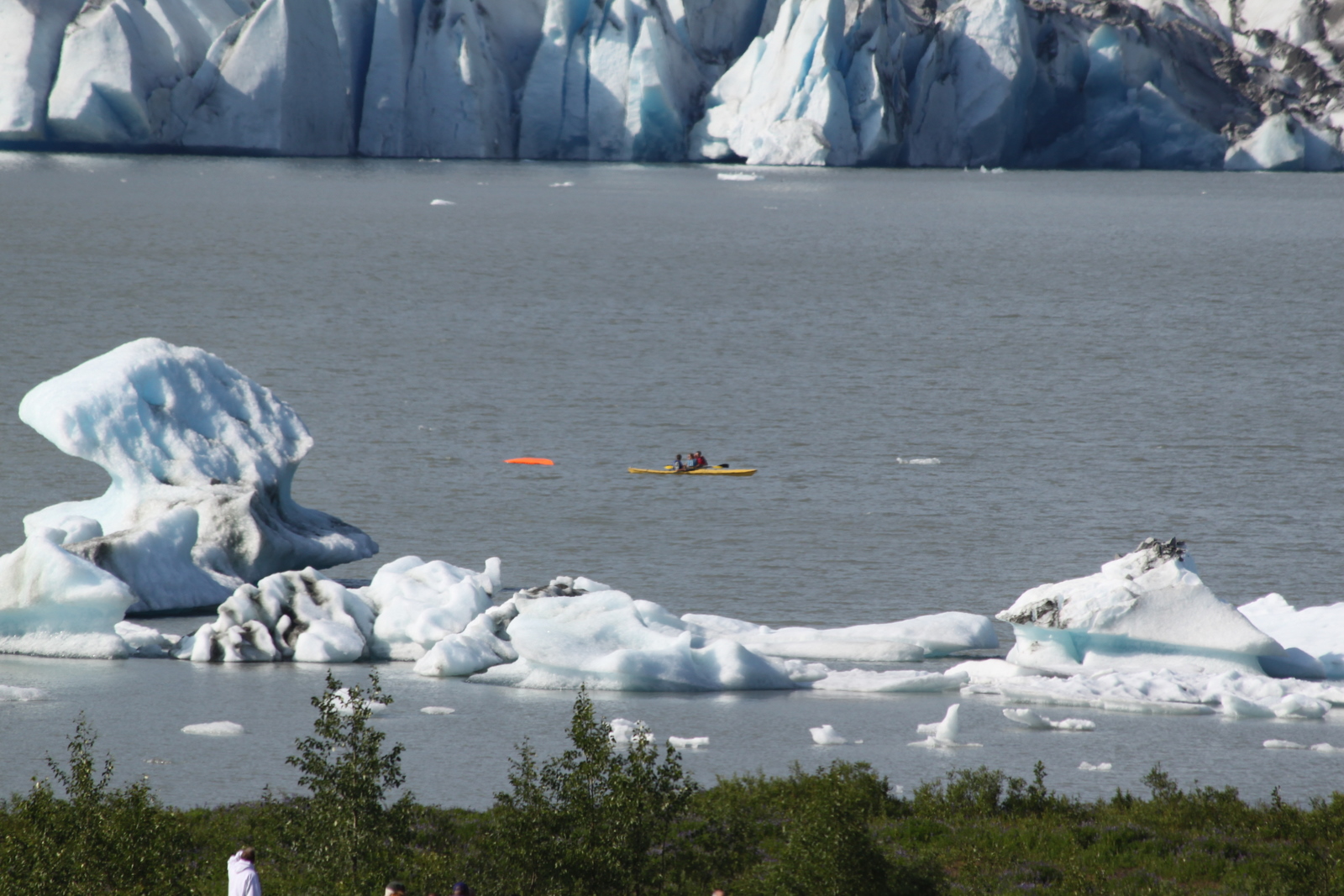
Mendenhall Glacier was a short ride from town. It has a wonderful visitor center and is easily accessible, but you can't walk out to it.

Mendenhall Glacier
Just as we arrived there was an incident with a capsized kayaker near the toe of the glacier. It was a tense scene at the visitor center, as authorities and tourists alike used spotting scopes to scan the frigid glacier waters for the overboard man. Fortunately everything turned out okay. His girlfriend helped pull him onto the front of her kayak, then paddled to the far shore from where a rescue boat picked him up, returning him to the visitor center where his relieved mother waited.

Capsized kayak in icy waters


While all this drama was going on, a little further away children splashed around in shallow pools formed by the melting glacier.

The next day we strolled around town a bit more, saw the Saint Nicholas Russian Orthodox Church and visited the Juneau-Douglas City Museum where we learned about things like Aleut hunting hats and gut parkas.

Susan tries on the Aleut hunting hat at the Juneau-Douglas City Museum

We also drove across the Juneau-Douglas Bridge to Douglas Island where it seemed a lot of regular people lived. We also drove the Douglas Highway up and around as far as we could go, for not particular reason other than to say we'd been there.

What we especially enjoyed about Juneau was watching the wildlife. With the salmon jumping and fisherman leaving scraps behind, the eagles were plentiful. Black headed gulls and Arctic Terns also caught our eye.


A Bald Eagle swoops by for salmon scrap snacks


While lingering at the water's edge, we got to talking with another couple who happened to be from Boulder. They were in Juneau for the summer as volunteers, providing transportation a couple times each weak for Juneau Icefield Research Program (JIRP) scientists in exchange for lodging in a private home on Douglas Island, and, in their case, use of a small fishing boat. Mike and I looked at each other and exchanged "hmmmm" looks.


Thursday we went out The Road and visited the Jensen-Olson Arboretum. A City and Borough of Juneau Park, this lovely and under-visited flowering refuge, set right against the ocean, was such a relaxing way to spend the afternoon. The Himalayan Poppy with its bright blue petals was my favorite. We visited with the grounds keeper and I envied his job.


Himalayan Poppy

Poker Primrose

Back in town we stopped at the Juneau Fish Hatchery and marveled at the determination of the spawning salmon in fish ladders.

Salmon at the Fish Hatchery

Our ship left that evening, so Friday morning was our last chance to visit the Last Chance Mining Museum. A short drive up Basin Road in the dense forest, Juneau felt a million miles away. We had parked in the wrong lot, but could see the museum so it seemed easier to take the short walk through the woods to get there, rather than move the car. As we headed down, visitors at that other parking lot were waving up at us. They were not just being friendly -- it turned out we had walked right past a bear with cubs, totally hidden from our perspective. Yikes!


Last Chance Mining Museum

The little mining museum was a bit tired and dusty, but very interesting nonetheless. When the docent learned where we were from, she grew a little crabby, complaining that the museum often gets calls for the Estes Park Super 8 by mistake. The two phone numbers differ only by area code: 907 vs 970.

On our way out, we watched visitors panning for gold ... and kept our eyes peeled for bears!

Fireweed and the mountains near Juneau

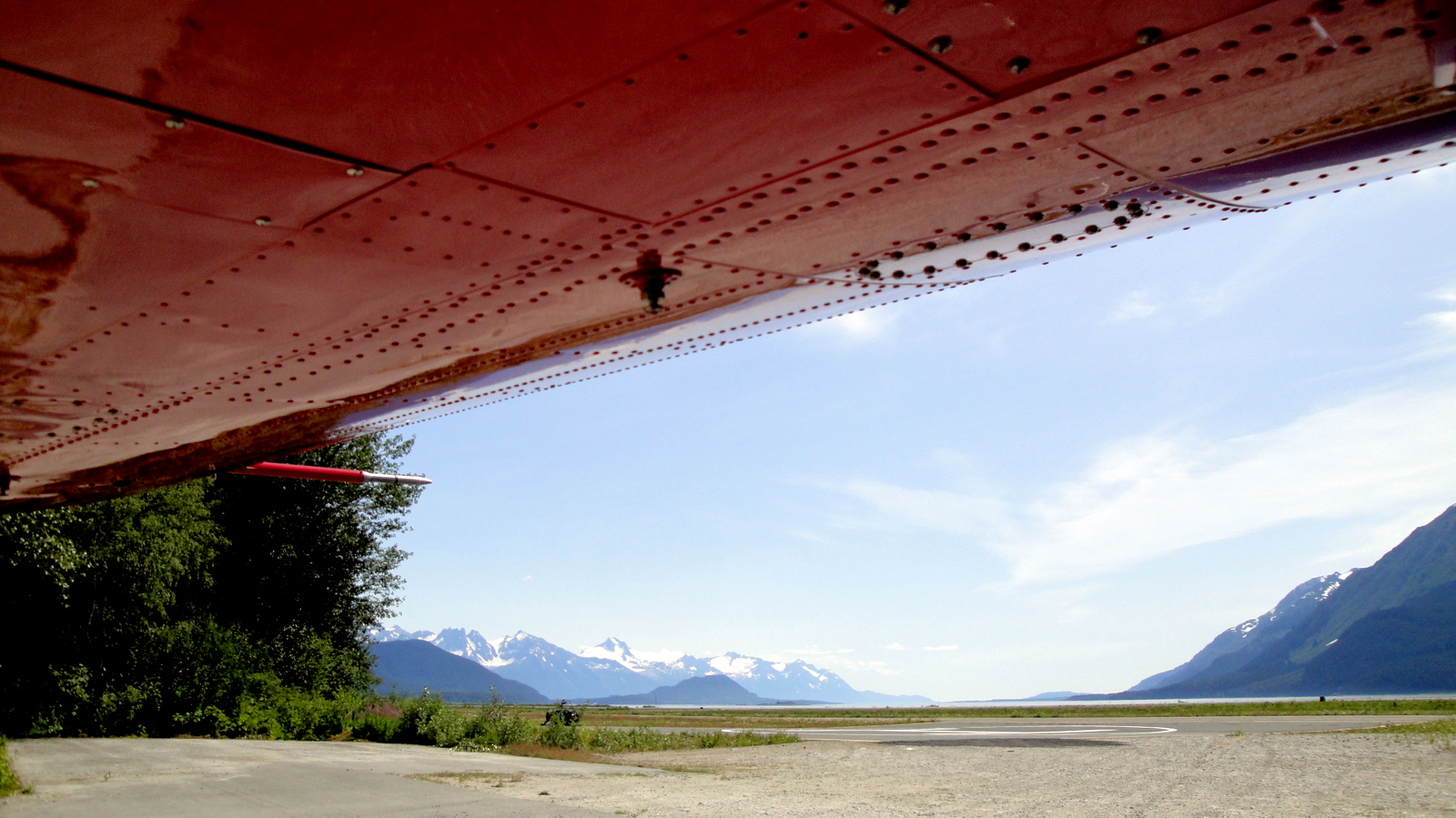
In just three hours we'd be on board the MV Malaspina.

Here's a map of our ferry ride from Haines to Juneau.


Glacier Bay Flight-seeing (July 13)

The 13th might be unlucky for some, but this day in July was one of the highlights of our entire Alaska trip -- or maybe any trip!

The marine wilderness of Glacier Bay National Park and Preserve includes tidewater glaciers, snow-capped mountain ranges, ocean coastlines, deep fjords, and freshwater rivers and lakes. The park lies west of Juneau, AK and can only be reached by plane or boat. The only road connects the small town of Gustavus and its airfield to park headquarters at Bartlett Cove (a mere 10 miles).

Bush Hawk-XP (photo courtesy of Mountain Flying Service)
This lack of roads is almost completely alien to our experiences as National Park enthusiasts and presented a unique challenge to even scratching the surface of appreciating this park.


So, we decided the best way to see it was to book a flight-seeing tour -- the three hour Pilot's Choice flight with Mountain Flying Service out of Haines. This flight included, at the pilot's discretion, a landing on a remote Gulf of Alaska beach on the Pacific. Maybe because of the economic times, or because we walked in and they had space available, we got a decent discount off the advertised rate for the flight.


About to leave the Haines aiport


We took off from the Haines airport in the beautiful red Bush Hawk-XP single engine plane piloted by owner Paul Swanstrom. Only one other passenger joined us for the flight.

After taking off from the Haines airport we rapidly climbed up and into the mountains of Glacier Bay NP. We flew over and even between snow-covered mountain peaks and had a totally unique perspective on the waterways of Glacier Bay and the glaciers that emptied into it.


It is difficult to find the words to describe the vastness and splendor of this place, and the photographs we took don't even begin to do it justice. Practically every minute of the flight was jaw-dropping and wow-inducing, but there were several highlights.


Lituya Bay

Our flight took us west to the Gulf of Alaska on the Pacific Ocean and we flew over and around the west side of Lituya Bay.

I was aware of Lituya because of a 2005 PBS NOVA episode about tsunamis. Here's the gist of the Lituya mega-tsunami event from the NOVA website:

Lituya Bay, Alaska, July 9, 1958
Tsunamis generally reach a maximum vertical height onshore, called a run-up height, of no more than 100 feet above sea level. A notable exception was the 1958 tsunami triggered by a landslide in a narrow bay on Alaska's coast. Its over 1,700-foot wave was the largest ever recorded for a tsunami. It inundated five square miles of land and cleared hundreds of thousands of trees. Remarkably, only two fatalities occurred. In the wake of the Lituya tsunami, scientists realized for the first time that a landslide—90 million tons of rock in the case of Lituya—could produce a giant wave.
Another highlight was flying over the outlet of the Margerie Glacier at the same time a cruise ship was departing. This was one of the few times there was anything man-made to give a perspective on just how enormous the glaciers were. The cruise ship looked like a toy.


Do you see the small boat? (click picture to enlarge)


Probably my favorite part of the flight was the landing on the beach on the Gulf of Alaska. Paul explained that we could probably land, as he had recently done so, but we would need to fly over the spot first to make sure there was no driftwood or debris there that would preclude a safe landing. After a quick flyby he determined it was safe, we came in from the south, flying over the La Perouse Glacier, and landed gently on the beach. Here's a video of the landing.


Almost as soon as we touched down, Paul began to turn the plane around to position us for take-off after our 30 minute or so stop. But the plane bogged down in the sand and wouldn't move. That was a surprise! Paul shut the engine down and calmly explained that the three of us would need to get out to reduce weight, so we did. After we got out and stepped back from the plane, he finished turning it around and taxied it a little south toward the glacier.


As we watched the plane move just a short distance away from us, it occurred to me how very far away from civilization we really were. Then in a fleeting moment of paranoia I thought to myself, "we'd be totally screwed if he just took off" and "what if the engine doesn't restart?" When we met Paul on the beach, I asked him about using a radio here and he explained that there was no coverage for radio (much less cell phones) unless another plane was nearby. He explained that he had a satellite phone with him if we needed it (and a handgun). Interestingly, while we were on the beach, another plane did fly by, just off the coast.


Here's a Google Maps satellite view of our landing spot:


View Larger Map

Paul pointed to some tracks on the beach and pointed out that we were seeing three different sets of tracks: grizzly bear, wolf, and moose. After walking up and down the beach and taking photos a little longer, it was time to reboard and we took off in just a few hundred feet and flew on up the coast. Shortly we saw sea lions and grizzly bears at various spots on the beach. Soon we turned back east and entered the mountains again.


As we flew back, Susan asked about our route and when Paul answered, she asked if we could go back a different way than the way we came to try to get a better view of Mt Fairweather. Paul looked at his watch and instruments, and to my surprise, said, "OK, I guess we can do that; that way may not be quite as scenic and it might take us a little longer to get back." Talk about accommodating!


Final approach to land at Haines airport


It would be hard to imagine a more spectacular scenic flight than this. It was expensive, but it was totally worth every penny. After we landed, I remarked to Paul that I could see how his biggest marketing challenge would be persuading someone to spend a lot of money on something they can't appreciate that they would want to see and experience -- until they've actually experienced it.

We would highly recommend this way of seeing Glacier Bay. When we return to Alaska I'm sure we won't hesitate to take another flight-seeing adventure!